Sunday, September 27, 2009

Mountain Trail Running Ute Peak: Perfect Views of the Gore Range and Blue River Valley

Mountain Trail Running Ute Peak: Perfect Views Of The Gore Range And Blue River Valley

As the fall colors are almost at their peak in most parts of Colorado, Tara and I headed up to run Ute Peak. We've done this one on numerous occasions, as it offers a fairly well marked trail for running, a solid ascent, lots of time above treeline, and spectacular vistas of the Gore Range and beyond. This time was not an exception, other then we decided to do the official Ute Peak Massif.

Why did I fall for the pre-dawn start again???

This mountain run is slightly different then doing just Ute Peak (12,303 feet). Rather, it involves tagging all of the minor summits of the entire Ute Massif. There are four (including the peak proper), and other then the far northern one, all can be tagged en-route to the official Ute Peak. This also adds a touch of vertical and a mile or two more to your day, but make the run all the better.

Ghost runner in a frost covered meadow...

To access Ute Peak, drive north from Silverthorne in Summit County on Highway 9. After about 10 minutes, you will see a turn off for Ute Pass Road. Take this to the top of Ute Pass and park in the pull-out. The trail begins right in the trees on the south side of the pass.

Running through the thick forest growth on perfect singletrack...

After quickly taking you into the forest, the trail climbs to a small overlook before once again dropping into the thick growth. As it winds around to the east side of the Ute Peak Massif, the trail passes through dense forests and meadows, eventually reaching treeline after a VERY steep section. Once at treeline, the views of the Gore Range are phenomenal. If you are going to tag all of the summits in the massif, continue straight up, angeling to your left (southeast), heading slightly away from the highest point on your right. This will take you to Ute Peak North. From here, stay on the ridge over Ute Peak Middle, then down and over to Ute Peak Proper. From here, descend south a couple hundred feet and then ascend up to Ute Peak South.

Finally reaching treeline and the views beyond...

After all four are done, you can avoid climbing over all of them again by simply skirting around the west side of Ute Peak Proper and Ute Peak Middle. Pick up the trail again, and then head back down the five long miles to your car.

The numbers for those who care.... 

Beginning Elevation: 9,400 feet 
High Point: 12,303 feet 
Total climbing and descending: ~ 6,000 feet 
Mileage: ~12 miles 
Other People Factor: minimal; I've done this run over a dozen times and have only encountered 3 parties on it (on a Sunday no less). 
Time: 3.5-6 hours depending on how often you stop to enjoy the views...

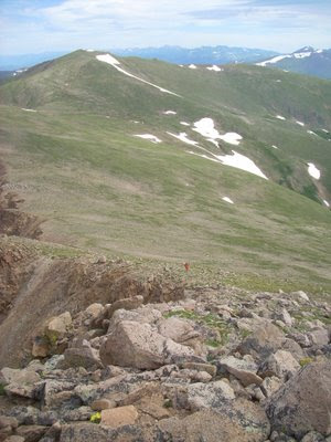
Looking at what still lies ahead (the first summit is on the left out of the photo)

Two down, two to go...


Running across the top of the world...


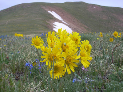
The alpine tundra in full fall glory!

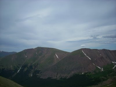
Panorama of the Ute Massif from Ute Peak North

Panorama of the Gore Range

Thursday, July 23, 2009

Ruby Creek Mega-Traverse: Engelman Peak, Robeson Peak, Bard Peak, Mount Parnassus, Woods Mountain, and One More

Bard Peak PanoramaPanorama of the Ruby Creek Mega-Traverse: First Part with Engelman, Robeson, Bard, and Parnassus

Second Part: Bard, Parnassus, Woods, and an un-named peak

Although I seem to be doing a lot of posts lately on the great mountain trail running Tara and I have been doing this summer, we have also been getting out bouldering - at least a couple days a week. It's just that we have not gotten any photos or have had anything worthy of posting. We did go up to Upper Chaos last week and climb many of the problems up there, including Riddles in the Park. However, the flowers seem to be trumping the boulders this year...

The Ruby Creek Mega-Traverse is an excellent full mountain day that sees very little traffic. Perhaps it is because there is no trail for the entire route (other then the first mile or so), it is all above 11,000 feet and covers six spectacular peaks, making it a long day.
Mining Reclamation in Ruby CreekMine reclamation project: see the sprinklers...

Tara on the climb to Engelman PeakTara climbing up the ridge to Engelman Peak

Lots of people either do Bard Peak (13,641 feet) or the traverse between Bard Peak and Mount Parnassus (13,574 feet), mostly from the Bakersville exit. However, to really get the full effect and to experience a ton of mountain solitude, one really should do it from the north via Ruby Gulch. This is also an excellent backcountry spot in the winter (shhhh, keep it quiet)
Bard Peak from Robeson PeakLooking at Bard Peak (number three) from Robeson Peak (number two)

Woods Mountain from Robeson PeakLooking at Woods Mountain (number five) and the no-name peak (number six)

Basically, one heads up to Jones Pass, but rather then going to the Henderson Mine area, hand a left and go to the Urad Mine. Right by the mine, there is a parking spot and you can see the access road with a big DANGER, AVALANCHE sign. Head up the road for about a mile until it splits. Follow this spur road as it degenerates into a trail. Right below treeline, you will run into a mine reclamation project with automatic splinkers at ~10,000 feet. Here is where the fun starts....
climbing up Bard PeakTara climbing up Bard Peak from Robeson Peak

pointing to Mount ParnassusPointing to Mount Parnassus (number four) from Bard Peak

Get onto the north side of the creek, and head northeast up slope until you get above the trees. Here you will run into several ridges and gullies. Take the middle ridge as it climbs via grassy slopes and talus up to the summit of Engelman Peak (13,362 feet). From here, head due south along the broad open alpine tundra down and then back up to the minor summit of Robeson Peak (13,104 feet).
Bard Peak to Mount Parnassus traverseThe traverse between Bard Peak and Mount Parnassus

Tara on Bard PeakFour down, two to go...

On Robeson Peak, you keep heading south, descending once again as you cross the wide upper tundra valley between Robeson and Bard Peaks. The climb to Bard has a little kick to it, as it reaches 13,641 feet. From here, head west along the ridge and traverse over to Mount Parnassus (13,574 feet). This is the only place you are likely to encounter people, with the views of Grays, Torrey's, and the surrounding mountains proving to be spectacular.
alpine wildflowersFlowers on the slopes of Woods Mountain

Engelman Peak and Robeson PeakLooking across Ruby Gulch at Engelman (on the left) and Robeson Peaks (on the right)

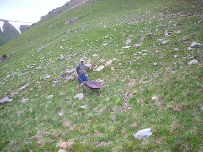
Once on the top of Mount Parnassus, head down the broad, steep grassy slope due west for almost 2,000 feet to the saddle between Parnassus and Woods Mountain (11,703 feet). Cruz up the little climb to Woods Mountain, and then you only have one final summit to tag. It doesn't have a name, but still deserves your attention as it completes the Ruby Gulch Mega-Traverse. From here, head down some of the old mining roads (none of them really link up), past the fields of alpine flowers, past the old mining ruins (the wheelbarrow made of solid metal and weighing in at over 50 pounds!!!), across Ruby Creek, and finally onto the final descent road. Run down the closed road and back to your car.
Bard Peak from the NorthwestBard Peak from the no-name peak

Indian Paintbrush wildflowersAlpine flowers on the descent

Now that is what a high-country traverse is all about and why the Colorado Rockies are so amazing.
mining wheelbarrowTry carrying rocks with this old solid-steel mining wheelbarrow!

Columbine flowersColumbine fields on the way down...

Saturday, July 18, 2009

Trail Running Up To Saint Vrain Glacier

Here is another post from a couple weeks ago...

One of the better mellow runs along the Frontrange is the Peaceful Valley/Camp Dick run. The trail winds its way along the north side of the South St. Vrain River for 4 miles, climbing gently from ~8,500 feet to ~9,200 feet. At this point, the trail comes out of the trees and joins up with the old mining road that used to go up towards Oglalla Peak and the Middle Saint Vrain River. The road is closed, as it is part of the Indian Peaks Wilderness area, but there is still some mining evidence at around treeline.
Peaceful Valley Camp Dick trail runningThe junction: the left turn goes to Buchannan Pass, the right goes to St. Vrain Glacier

You can either turn around here for an easy 8 mile run, or you can continue up for several more miles to the Saint Vrain Glacier (really just a permanent snowfield) or to Buchannan Pass (a great run, but one I prefer to do from Beaver Reservoir via Coney Flats).
Swampy trail running in the Rocky MountainsThe swampy trail disappears; not many people get up here...

When I ran this with my camera, the snow was still melting at a fairly good rate, and several miles above the split to Buchannan Pass or Saint Vrain Glacier the trail disappeared and turned into a swampy mess. I kept going all the way to the Glacier, but before I could tag the summit of Ogalalla Peak the storm clouds were really rolling in.
Storm clouds over Ogalalla PeakStorm clouds building over Ogalalla Peak, the Glacier is just up the bench on the left

No worries though, the flowers were blooming, the trail was empty (except for the lower section around Camp Dick), and a number of boulders revealed themselves to me. Plenty of undone boulder problems are waiting for anyone who wants to haul in a pad (7 miles one way).
secret boulder in peaceful valleyUndone boulder problems up high...

The numbers for those who need them:

Elevation: Starts around ~8,500; ends around ~11,600 (unless you do the last 500 feet to the Divide).
Miles: ~7.5 miles one way.
Time: ~3 hours depending on how often you stop to take in the views and snap photos of flowers
undone bouldering in rocky mountainsAnother hidden gem of a boulder...

Indian Paintbrush FlowersThis is why you run in the Rocky Mountains... Indian Paintbrush

Columbine FlowersColumbine in full glory...

Thursday, July 16, 2009

Major Trail Run in Major Creek: Running Electric Peak

Major Trail Run In Major Creek: Running Electric Peak

One of my favorite places to run is in the San Luis Valley of southern Colorado. With numerous trails above 8,000 feet, grand vistas of the Rio Grande River and tributaries, as well as the San Juan and Sangre de Cristo mountains, running trails in the San Luis Valley is always a great experience. A bonus is that there are usually few - if any - people out on the trails. Of course there are always parties up in Como Basin trying the Little Bear-Blanca-Ellingwood link-up (a spectacular climbing traverse of three 14ers), or some around the Crestones, the rest of the valley and trails see little traffic. Last year we ran Simmons Peak for example, a little known 12,000 foot mountain in the north end of the valley; only five other people had signed the summit register since 2003!

Moon shot over the San Juans...

I grew up spending lots of time in the Valley, especially around Valley View Hot Springs, as my parents used to have memberships there (back when it was private and the only way you could soak was if you were a member). Now, I try and get down there a couple times per year. In the winter, the trail running on the lower trails is excellent, and the climbing and bouldering is some of the best in the state. However, on this run Tara and I wanted to run Electric Peak (13,598 feet) via Major Creek.

Tara running through the thick growth in Major Creek

Major Creek is a large drainage coming out of the Sangres that offers some of the best wilderness in the Valley: aspen groves, desert scrub, alpine tundra, evergreen forests, beaver ponds, and more. In fact, from the beginning of the trail head to the summit of the peak one travels through no less then 4 different ecosystems! Running through this country is always a pleasure.

One of the spectacular meadows on the way to Electric Peak (Lakes Peak is on the left)

Attempting Electric Peak (and its neighbors Lakes Peak and Thirsty Peak) from the Major Creek trail head is a long day, with over ~5,600 feet of elevation gain. We camped at the trail head among the Gamble Oak, as it is too far from anywhere to drive there in the morning.

Moths on the flowers...

The trail is fairly straight forward for the first 5 miles, at which point one needs some good route finding skills to get through the giant mud slide that came through in the Spring of 2009. This mud slide originated on the west slopes of Electric Peak and inundated most of the trail down past treeline.

Blissful aspen running...

Run the trail as it skirts along in the desert scrub, quickly dropping you into Major Creek proper. From here, the trail crosses Major Creek only twice (it used to cross it more, but was re-routed in 2006 because of the beaver ponds causing flooding on the trail), staying on the north side through flowers, meadows, aspen forests, and more. It eventually disappears in a large meadow, at which point the mud slide takes over. Trying to find your way through here can be difficult; - here is the beta: run up the main mud slide path for a couple hundred yards, then quickly angle north and east across the slide until you find the trail again.

The mud slide...

Keep running up the trail as it begins to gain some elevation, until again it disappears in the mud slide. Follow the mud slide, staying directly in/on it until above treeline. Continue on the slide until you almost (note: almost) reach the true west side of Electric Peak. Look left for cairns, taking the trail as it steeply switchbacks up to the pass between Lakes Peak and Electric Peak. From the pass, one simply has to head south along the ridge to the top, enjoying the amazing vistas of the San Luis Valley to the west and the Wet Mountain Valley to the east.

The numbers for those who care.... 
Beginning Elevation: ~8,600 feet 
High Point: 13,598 feet 
Total Elevation (ascending and descending): ~10,000 feet 
Mileage: ~13 miles, but it feels like a lot more 
Time: 4-6 hours 
People Factor: None

Mountain thistle!!!

Running up to the pass...

Beautiful views (wind anyone?)

Done!

Looking down Major Creek and into the San Luis Valley...

The view into the Wet Mountain Valley...

Monday, July 13, 2009

The Brainard Lake Loop: Trail Running in the Shade

I'm trying to catch up on my posts. One of the things that has been slowing me down is I'm trying to find a way to do maps and profiles of the trail runs. I thought Google Earth would allow me to do this, but I've got to mess around some more before I figure it out. So, I'll just have to forgo any maps for now (if you know how to do this, shoot me a line). Besides, this way there is more adventure.
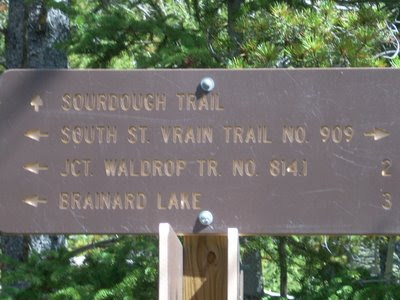
The first junction after crossing the river. Head west on the South St. Vrain/Waldrop Trail

The Brainard Loop is an excellent trail run for those hot summer days. With most of the trail in the shade, this one is great when the sun is out and the temps are hot. Plus, you can always soak your feet in the various rivers if need be (or dunk your hat).
Stream crossing... dip your hat in for a cool head.

I park outside of the actual recreation area, as they collect a fee now. Park at the turn around just before the gate (this is where they close the gate in the winter) and head north along the Sourdough Trail towards Beaver Reservoir. The trail quickly drops here as you head down towards the river. Cross the river and shortly after the trail splits. Take the left hand trail (the right goes to Beaver Reservoir) and begin to follow it west as you wind your way up. You roughly follow the river, but eventually you break away as you run through beautiful pine forests. There are a couple stream crossings along the way. Eventually you will meet up with the Waldrop Trail (also called the North Trail), which you continue on as you head towards Brainard Lake.
The junction of the South St. Vrain and Waldrop trails. Stay on the South St. Vrain trail here.

Stay right on all junctions, eventually coming out above Brainard Lake onto the road between Brainard and Mitchell Lake parking areas. Run the road briefly up towards Long Lake and Lake Isabelle, where you get back onto the trail.

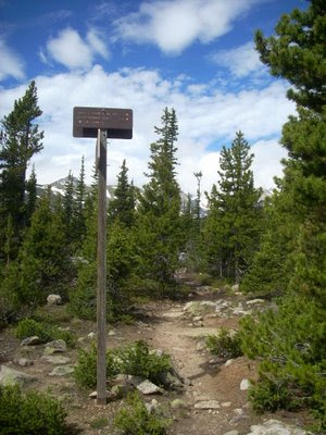
Before you get to the road. The sign is so high off the ground because of winter snow levels. In the winter, this little spot is called the "arctic circle" for those familiar with coming in on the North Trail and going to the cabin.

Here I run around Long Lake on the Jean Lunning trail. Run this trail all the way around Long Lake and then back down to Brainard. From here, I usually run around the south side of the lake and pick up the Little Raven trail. This trail is great, and was fixed up in 2007 so it is much easier to follow. It runs south and east, eventually dropping you onto the dirt road from Left Hand Reservoir. Run down the road for about .5 miles, and then head due east back onto the Little Raven. This little spur section will drop you onto the Sourdough Trail, at which point you can head north again and back to your car.
The view from the Jean Lunning Trail.

All in all, this is a great loop run at mid-elevation. With little or no people, I often hit this one when I'm looking for something local and fast.

Since I can't do a profile yet, here are the estimated numbers.

Distance: ~10 miles
Elevation: 9,800 - 10,600
Time: ~1.5 hours