Wednesday, October 20, 2010

Trail Running the High Lonesome Trail

Trail Running The High Lonesome Trail: Sweet Running Through Forests And Meadows In The Mountains

The other day Tara and I decided to run the High Lonesome Trail. This is a really good trail that follows part of the Continental Divide Trail and passes through numerous high-mountain meadows and forests. We ran the trail from Devil's Thumb Park to Meadow Creek Reservoir and back. You can keep going all the way to Monarch Lake to the north, or you can cruz up Devil's Thumb Pass on the south. Since we have been doing a lot of longer runs, we wanted something a little mellow. Plus, there is snow up on the pass making any running up there difficult.


The trail is fairly easy, as it meanders along from north to south at the base of the Divide. The numerous mountain meadows or "parks" are beautiful, and worth a quick stop at each one. The trail sees little traffic, so you are likely to be the only runner out that day.

Saturday, October 2, 2010

Trail Running St. Louis Lake: Peaceful Mountain Running in the Proposed Williams Fork Wilderness

Trail Running St. Louis Lake: Peaceful Mountain Running In The Proposed Williams Fork Wilderness 

Early this morning Tara and I set out for a nice long mountain trail run. We decided to cruz up to St. Louis Lake up high on the shoulders of St. Louis Peak in the proposed Williams Fork Wilderness. This is a beautiful area that is surrounded by forests and lesser-known mountains, with little or no traffic. Approaches are long and convoluted, so your chances of seeing people are pretty slim - except on the highest of traffic days. St. Louis Peak, Bills Peak, Bryers Peak, and other bumps compose this massive uplift of mountains that has only 2 real access points. The St. Louis Creek road is the one we chose this time. 

The actual "trailhead" after 3 miles of running... 

Drive 7.5 miles from Fraser along the St. Louis Creek road until it dead ends at a gate. The gate blocks all motorized traffic into the St. Louis Creek drainage. From here, run (or bike) for 3 miles as you climb up to the actual "trailhead." Continue along the trail for another 1.5 miles to a branch, at which point you can chose to either go right to St. Louis Lake or left to St. Louis Pass. You can link up a bunch of trail from here, and eventually wind your way back to Winter Park, Berthoud Pass, Jones Pass or the Williams Fork drainage. 

The turn-off to St. Louis Lake 

The Lake is a small, serene tarn lake in a floating valley. Enjoy the solitude as you will be the only other person in the area most likely. The view from the far side of the lake back down the St. Louis Creek drainage is stellar. On this morning (a Saturday no less) I saw zero people. It took 2:22 hours with some time spent at the lake to eat and rest the feet. 

Miles of empty trails to run... 

The quiet and empty St. Louis Lake - a perfect trail destination 

The numbers for those who care....

Beginning Elevation: ~10,240 feet
High Point: ~11,600 feet
Total climbing and descending: ~2,720 feet
Mileage: ~13 miles roundtrip
Other People Factor: minimal
Time: 2-5 hours depending on how often you stop to enjoy the views...

Friday, September 10, 2010

Trail Running Satanta Peak from Arapaho Pass and Caribou Pass

Trail Running Satanta Peak From Arapaho Pass And Caribou Pass 

The other day we decided to cruz up and do one of our usual mountain runs. The 4th of July trailhead provides a number of good runs of short to moderate distance: Arapaho Pass, North Arapaho Peak, Caribou Pass, or Satanta Peak. 


Looking from Satanta's Summit out to the summit of the spur ridge 

Usually Arapaho Pass is run early in the year, as it melts out fairly fast and is a good indicator of one's mountain running conditioning going into summer. South Arapaho Peak we usually run late in the season, often as a goodbye to the season. This is a great lung-buster of a run and it can be done in just under 3 hours roundtrip (my PB is 2:54 minutes roundtrip). 

On the summit of Satanta Peak - you can see Navajo and Dicker's Peck in the background 

The other one I like to run out of this trailhead is Satanta Peak via Arapaho Pass and then Caribou Pass. Although not too long (8 miles roundtrip), the run offers some splendid views and a fair amount of seclusion. 

From the Spur Summit looking back over Satanta Peak and into Middle Park 

Do the usual run up to Arapaho Pass via the 4th of July trailhead. From the top of the Pass, don't drop down to Columbine Lake, but rather continue up and west a little as the trail heads to Dorothy Lake. Before the lake, the trail splits and you head due west as the trail cuts across the north face of Mount Neva. There are some nice views here. After a short distance, you reach Caribou Pass and the last spot you are likely to see anyone. From the pass, run due north on the ridgeline towards Satanta Peak (11,979 feet). The "true" summit is just a blip, but the real treat is running the extra .5 miles on the spur ridge that places you in a nice position suspended over the Columbine Lake Basin. This is an amazing location, one seldom visited by other folks. From there, turn around and head back home. On this day it took us 2:42 minutes for the entire trip. 

No flowers, but ptarmigan! 

The numbers for those who care.... 

Beginning Elevation: ~9,600 feet 
High Point: 11,979 feet 
Total climbing and descending: ~ 4,100 feet 
Mileage: ~8 miles roundtrip 
Other People Factor: moderate to minimal 
Time: 2 - 4 hours depending on how often you stop to enjoy the views...

Saturday, August 7, 2010

Mountain Running Parry Peak, Mount Bancroft, and James Peak: Quiet Trifecta on the Continental Divide

Mountain Running Parry Peak, Mount Bancroft, and James Peak: Quiet Trifecta On The Continental Divide 

The other day we went out to do another link-up of peaks in the Colorado Rockies. Setting out for a good mountain run with both on-trail and off-trail terrain is always exciting. The Parry/Bancroft/James link-up is a perfect example. With some 4wd road to start, some nice single-track to end, and a bunch of off-trail terrain in between this is another classic - and it is on the Continental Divide so the views and position are spectacular. 

Tara on the run up, Alice is down and in the distance... 

To do the link-up, drive up to St. Mary's Glacier and turn off at the town of Alice for the Loch Lomond trail and lakes. You can drive up this road for 2 miles to Loch Lomond proper, but we decided to park early to get in a little more mileage - and save our car's shocks! 

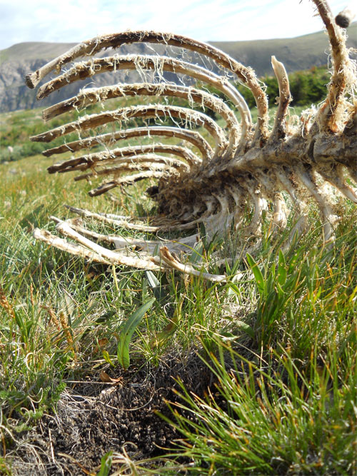
Elk carcass on Bancroft's slopes... 

Run up the road to Loch Lomond - as you reach the Loch you can begin to orient yourself - Parry (13,391 feet) is on your far left, Bancroft (13,250 feet) is straight ahead, and James (13,294 feet) is back and to your right. At the Loch, there is a closed jeep road that quickly turns into a trail on the west side right before the dam. Take this as it will get you onto Bancroft's southeast ridge. Follow this up for 2,000 feet keeping to your left as you go up. This will put you just below Bancroft's summit proper, and allow you to cruz over and tag Parry's summit. From here, follow the ridge - Continental Divide - back north over Bancroft's summit and then down into the saddle between Bancroft and James' east slopes. 

Tara on Bancroft - Parry in the background... 

Once in the saddle, pick your way up onto James' east slopes, tag the summit, and then follow the single-track trail as you run back down through Jamaica Plateau. Keep your eye on the Loch below as you stay on the righthand side - there is a trail that you can pick up and which will drop you right onto the far side of the dam at the base of Loch Lomond. From here, run the road back the 2 miles to your car. On this day it took us 3 hours and 39 minutes. 

James Peak - the final peak of the day from Bancroft... 

On James, ready to head back down... 

And of course, flowers... 

The numbers for those who care.... 

Beginning Elevation: ~10,600 feet 
High Point: 13,391 feet 
Total climbing and descending: ~ 6,200 feet 
Mileage: ~9 miles roundtrip from the Alice
Other People Factor: minimal Time: 3 - 5 hours depending on how often you stop to enjoy the views...

Sunday, August 1, 2010

Mountain Trail Running Hassell Peak: Excellent Alpine Single-Track

Mountain Trail Running Hassell Peak: Excellent Alpine Single-Track

The other week Tara and I headed up to run Hassell Peak (13,215 feet). Although one starts out at the overly popular Herman Gulch trail head along I-70, trail running up Hassell Peak is really a remote, quite run that takes you through two beautiful alpine valleys. 

Looking towards the saddle between Woods Creek and Herman Gulch... 

The initial climb is a calf-buster, but after about 1 mile and close to 700 feet of vertical gain, you enter Herman Gulch proper. This is a gorgeous alpine valley with spectacular wildflowers and vistas. Most people that are on this trail are heading towards Herman Lake - a fun run in its own right at ~7 miles - but for this run you don't quite go to the lake. Rather, about .5 miles before you reach the lake, after your final steep climb a junction appears in the trail, with the option to head east over to Woods Creek. Take this junction, head around as you cross over a saddle and then wind your way along the edge of Woods Creek Valley. 

Hassell Peak from the saddle of Woods Creek and the broad southeastern slope... 

Here is where you will lose all people and have the rest of the run to yourself. You will also be able to see your objective from here, as the trail winds it's way around the edge of Woods Creek Valley and onto the broad south slopes of Hassell Peak. 

Tara running the alpine single-track... 

Prepare yourself, because the climb up the broad southern slopes of Hassell Peak is long and steep. Work you way up, eventually reaching the Continental Divide just shy of Hassell's true summit. Make a quick tag of the summit, and then follow your footsteps back to the car. While you are up there, you can also scope out several fun link-ups (Jones Pass to Loveland Pass is the best and easiest). On this day it took us 2 hours and 41 mintues. 

From the top of Hassell Peak... 


The numbers for those who care.... 

Beginning Elevation: ~10,200 feet 
High Point: 13,215 feet 
Total climbing and descending: ~ 6,000 feet 
Mileage: ~10 miles roundtrip from the Herman Gulch trailhead 
Other People Factor: moderate (weekdays) to extreme (weekends) 
Time: 2 - 4 hours depending on how often you stop to enjoy the views...