Trail Description
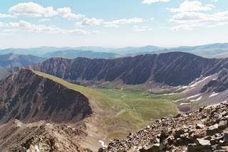
The challenging trail run to South Boulder Peak rewards visitors with unparalleled 360-degree views of the eastern plains, Boulder's front and back ranges, the Indian Peaks and Continental Divide. Boulder's extensive trail network allows for several routing options: the following describes the Homestead-Shadow Canyon-Bear Peak West Ridge route, and is highly recommended for its beautiful scenery, difficulty, and lighter trail traffic.

From the South Mesa Trailhead parking lot, cross over the footbridge and follow signs to the Homestead Trail (.1 mile) - bear left. The Homestead Trail rises quickly up through the initial mesa climb, then gradually climbs through open treed slopes.
The Towhee Trail merges with the Homestead Trail after 1.35 miles, and then shortly after merges with the Shadow Canyon Trail. The Shadow Canyon Trail joins a fire road at this point (6,275). Turn left on the fire road and climb methodically over well-groomed terrain for .7 miles to the last Mesa Trail access point, and beginning of travel up Shadow Canyon (2.1 miles : 6,582).
Here the trail is considerably more strenuous, climbing 1,967 in just 1.25 miles to reach the summit. Lingering winter conditions will amplify this challenge. The trail twists and weaves tightly along a faintly marked path amid notably large boulders and old-growth ponderosa and lodgepole. Look for occasional signs posted on trees to the right of the trail for guidance. Though views are limited, the dark, boulder-laden forest itself is quite scenic and serene.

The grade eases upon reaching the Shadow Canyon Trail - Bear Peak West Ridge Trail junction (3 miles : 8,155). Take note of young aspen groves on the saddle before turning left (south) for the last .35 miles to South Boulder Peak. The final 100 yards run up a steep scree field; extra caution is necessary when snow, ice or strong winds are present.
The summit is small and pointed, but the large boulders comprising it afford ample room for a handful of visitors to find small nooks with sensational panoramas.
No comments:
Post a Comment