Showing posts with label Byers Peak. Show all posts

Sunday, August 12, 2012

Keyser Creek Loop - Byers Peak and Bills Peak

Keyser Creek Loop - Byers Peak and Bills Peak


Ran the loop around the Keyser Creek basin today, with summits of Byers Peak (12,804') and Bills Peak (12,703'). This is another excellent loop run traversing a high alpine basin in the Vasquez Wilderness. I started at the Deadhorse trailhead, running up the secret trail until hitting the road to the Byers Peak trailhead. From there, I ran up the Byers Peak trail to the summit of Byers. From here, you descend off the south side of Byers, following the ridge. There is no trail from Byers to Bills, but it is fairly obvious and the ridge holds a fun section of 2/3 class scrambling. Once you are on Bills, you are at the southern end of the Keyser Creek basin, and can look across towards Bottle and your way back home. From Bills Peak, you run down west and then north along the long Bills Peak ridge mostly off trail, although there are faint markings for the St. Louis trail. Take this all the way back to treeline, and when you can see Lake Evylen on your left (west), go another couple hundred yards on the ridge and then make a sharp turn back east and south and drop into the Keyser basin. There are some cairns here, but the trail pretty much disappears in the basin, as you descend and then follow along Keyser Creek. Every once and awhile you will see a cairn, but I spent some time trying to figure out just which way to go. Eventually the trail re-appears and you can follow it to the junction for Bottle Pass. Run back up and over Bottle Pass and then back down the other side to the regular Byers Peak trail. From here, just head on back down and retrace your steps.

Byers Peak sees some traffic (I ran into one party on it today, Sunday), but Bills rarely sees anyone on the summit, and from Byers to Bills and into the basin and then back to Bottle Pass you will not see anyone. It is evident just how empty this area is (it is an official wilderness area) by the fact that the trail really does not exist along this entire way - you are mostly running on alpine tundra and then scree and mossy grass down in the basin (so it can be slow going at times). The full loop is 19.1 miles with ~6,100' of gain and ~6,100' of loss. Today I ran the loop in 4:44 with time for pictures and food on the summits. The loop can be done faster, but since this was my first time, I spent a little time trying to find my way in the Keyser basin and enjoying the views.

 Looking at Bills from Byers summit
 South off of Byers summit
 Looking back at Byers from Bills summit
 Looking back at Bills after the long ridge around the basin
 The sign in the bottom of the basin showing you are on the right path
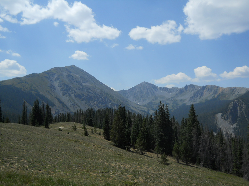
 From the fake Bottle Pass looking at the Keyser Creek basin. The run follows the skyline from left to right and beyond

Tuesday, June 19, 2012

Byers Peak - Full

Byers - Full


This morning I ran the full version of Byers Peak (12,804). Byers is the dominate peak in the valley, and I love running this peak. However, this time I did the "full" version, in that I started and ended at Creekside, which adds a significant amount of miles and vert to the peak. I ran up Creekside, then jumped over to Deadhorse and up the secret trail to the Byers trail, and from there up the standard north ridge. Once on top, I got to enjoy another solo summit in the Byers Peak Wilderness (combined with the Vasquez Wilderness and the Williams Fork Wilderness, this is a vast area that sees little in the way of people). Then it was time to head down and make my way all the way back to Creekside. I wanted to get in a semi-long day as the North Fork 50K is in a week and a half, and I am still working on my fueling after my disaster bonk at the Sage Burner. I tried to eat every 30 minutes or so, and that seemed to work. It was really hot, and although I had two hand-helds and a hip belt with 20 ounces, I drank all of it and sure could have enjoyed some more. The full version of Byers Peak is 20.9 miles with 5,159 feet of climbing. It took me 3:48 today, and I did take a few pictures and do several hat dips in the streams.

A nice elevation profile
 
The ptarmigan just hung out on the rock as I went by...

 
Looking south at Summit County and beyond....


Looking northwest towards Steamboat...


The fun Byers Ridge part of the run...


Tuesday, August 2, 2011

Speed Running Byers Peak in Grand County

Speed Running Byers Peak In Grand County 

Byers Peak looms over the Fraser Valley, and is a spectacular peak to trail run. With an excellent trail all the way to the top, and stunning views of the Williams Fork drainage, Gore Range, and Fraser Valley running Byers Peak is a locals favorite. We ran it last week and only saw one other group. Another amazing mountain run in Colorado's high country. It took me on this trip 2:27 roundtrip. 

On the way up... 

The "mandatory" self-portrait at the top... 

Looking across the Fraser Valley to the Divide from the top... 

The Williams Fork drainage.... 

Tara running down... 

Flowers are still going strong! 

The numbers for those who care....

Distance Roundtrip: ~8.6 miles roundtrip 
 Start Elevation: ~9,900 feet 
High Point: ~12,804 feet 
Total climbing and descending: ~3,808 feet 
Difficulty: Medium 
Other People Factor: Minimal Time: 2 - 5 hours depending on how often you stop to enjoy the views.

Sunday, October 24, 2010

Mountain Running Byers Peak: A Final Trail Run for the Season

Mountain Running Byers Peak: A Final Trail Run For The Season 

A couple days ago we decided to run Byers Peak. This is a local peak, and with some of the snow from the last storm melted, we thought we would give it a go. It is always nice to close out the trail running season with one more peak under your belt. Byers Peak is a perfect one. The trail is well marked, its steep, and the views are spectacular.

Looking back down the snow covered ridge... 

With the snows up top, there was not a single person on the entire mountain or in the surrounding woods. Mountain running late in the season like this is just perfect. Despite the 1-2 feet of snow on the final mile long ridge, we managed to do this run in 2:37 roundtrip. 

The ubiquitous summit shot... 

The numbers for those who care....

Distance Roundtrip: ~8.6 miles roundtrip
Start Elevation: ~9,900 feet
High Point: ~12,804 feet
Total climbing and descending: ~3,808 feet
Difficulty: Medium
Other People Factor: Minimal Time: 2 - 5 hours depending on how often you stop to enjoy the views.