Sunday, June 28, 2009

New Problems at Keystone: Bouldering and Future Problems

Last week Tara and I made our first trip up the the Keystone boulders for the season. This is a spectacular place, with unprecedented views of Buffalo Mountain and the Summit County valley. Climbing up above the stuff we developed last season, we found another series of gems with hard problems coming out of several cave-like boulders strewn amongst the talus. There is still a ton of undeveloped stuff up here, most of it needing some serious cleaning.
Tara bouldering in Keystone, Summit County, Colorado
Tara on the lower section of the left cave problem

Keystone bouldering, Summit County, Colorado
The lower section of the left cave problem

Summit County, Colorado, Keystone bouldering problems
Moving into the crux of the left cave problem

Keystone bouldering in Summit County, Colorado climbing
The right cave problem, getting into the undercling for the big throw...

bouldering in Keystone, Colorado
Sticking the crux mega-reach on the right cave problem

future boulder problems in Summit County
Contemplating future problems...

Wednesday, June 17, 2009

Running Mount Neva and Arapaho Pass: Indian Peaks Wilderness

Here in the Northern Colorado Rockies, we have had a slow start to the alpine trail running season. Usually by this time most of the peaks are free of major snow patches and the trails are relatively dry. Not this year. We have had consistently cool days and nights, so the snow has stuck around longer then usual. No problem, you just have to be willing to get a little wet...
Mount Neva and Arapaho Pass
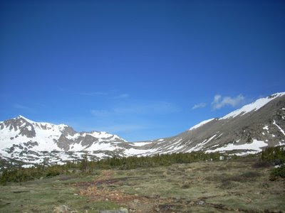
Mount Neva is on the left, we ran up to the pass and then took the north ridge to the top.

Today, Tara and I decided to see how the Arapaho Pass (11,906 feet), Caribou Pass (12,110 feet) area was doing. This is one of our standard trail runs during the summer, as it is easy to access and can be banged out either before or after work. The trail up to the pass is 90% dry, with only a few sections of snow that one has to post hole through. Getting to Caribou Pass, however, is still difficult. The usual route around the north side of Mount Neva (12,814 feet) is still snowed in. So, instead we decided to cruz up Neva's north ridge and tag the top.
Looking North to the Never Summer Range and the Indian PeaksLooking north from the top towards the Never Summer Range and RMNP.

Neva is a great mountain, with outstanding views on all sides of the Continental Divide, Grand Lake to the west and the Gore Range, the Never Summers to the north, and Mount Evans and James Peak to the south.
The Gore Range from the top of Mount NevaThe Gore Range from the top.

trail running up Mount NevaPart of the ridge to the top of Neva

The storm clouds came as usual, and by the time we were heading down things started to look ominous. A classic trail run in the Colorado Rockies: snow, water, thin air, crisp temps, and amazing views. Who could ask for more?
Tara running the talus up Mount NevaTara running up the talus to the ridge of Mount Neva

Trail running down Mount NevaMe running down; see the clouds building in the background...

And of course, there are the wildflowers just starting their season...
Alpine flowers on Mount Neva
If you are stuck on numbers, here they are:
Elevation Gain: ~2,694 feet
Distance One way: 4.2 miles
Arapaho Pass elevation: 11,906 feet
Mount Neva elevation: 12,814 feet

Sunday, June 14, 2009

Chaos Canyon Bouldering: Tommy's Arete in RMNP

On Friday Tara and I went up into the Park to check conditions and see what the snow was doing. Surprisingly, there is still a ton of snow in Chaos - both Lower and Upper. The Gobot area is burried, Stars and Stripes is just emerging, the Bush Pilot was completely under snow, and so on. Luckily, Tommy's Arete was dry, so we did a couple laps on that before heading down canyon to some stuff that was dry.
Tommy's Arete in chaos Canyon, RMNP

Chaos Canyon in RMNP Tommy's Arete Bouldering

Bouldering in Rocky Mountain National Park Chaos Canyon

Everything else in Chaos is pretty much still snowed in for a couple more weeks. If we get some hot weather, it could melt out faster.

Monday, June 8, 2009

Mountain Running St. Vrain Mountain: Fun in the Snow

As I mentioned, I was doing two posts on some of the recent mountain trail running conditions here along the Colorado front range. Kingston Peak from the Tolland Road out of Rollinsville is a great one. Another one, often that requires a little more melting out of snow before it is runable, is St. Vrain Mountain.
Trail running snow to St. Vrain Mountain
As of May 31, there was still a bit of snow. The trail was dry up until about treeline, at which point I had to do some serious snow running. However, the day was too good, the sun was shinning, and I was excited to be up high again. No one had made it across the substantial snow fields, up past the first headwall, across the flat saddle above treeline, and then up the final face of St. Vrain Mountain.
Views from St. Vrain Mountain
I guess as they say, the early bird gets the worm...
On top of St. Vrain Mountain

Round-Trip Length: 8.9 miles (includes .75 mile unmaintained segment to summit)
Start - End Elevation: 8,940' - 12,162' (12,162' max elevation)
Elevation Change: +3,222' net elevation gain (+3,370' total roundtrip elevation gain)

Directions:
To get to the St Vraim Mountain Trailhead take Highway 7 south from Estes Park to the town of Allenspark. Just inside Allenspark turn right on Ski Road (107) and follow it for 2.2 miles to the trailhead.

Friday, June 5, 2009

Mountain Running Kingston Peak: Early Season Peaks in Colorado

I've gotten behind on posting, but that is to be expected. When you live in Colorado, it seems a little odd to be writing about the mountains instead of playing in them. No worries, I'll put up two posts here on the recent mountain trail running and conditions.

Another early favorite mountain trail run that I like to do is Kingston Peak (12,133 feet). There are a couple of ways to go about it, but I usually come up the Tolland Road from Rollinsville. This is an excellent mountain hill run: The Tolland Road is a lung and leg buster. No warm up, as it goes at a fairly steep grade all the way past the turnoff to Apex (an old mining town). Once you pass the turnoff, keep going straight and head up and over, then down into a nice saddle. From here, you are at the base of Kingston proper, and the summit is only a mile or so away.
Trail running Kingston Peak out of Rollinsville, Colorado
Most of this route is above timberline with outstanding 360degree views much of the way. Several fourteeners can be seen from the top, including Longs Peak to the north and Mt. Evans to the south. Immediately west is James Peak at 13,294 ft. On a clear day, you can see Interstate 70 and Georgetown to the south.
Colorado mountain views from Kingston Peak
As you can see from the photos, most of the snow has melted out, and by now it is all dry. If you are looking for an excellent mountain tail run this early in the season (most of the high single track is still snowed in), then try Kingston. Rarely is there a person or car to be found, and the views are excellent.
Trail running to Kingston Peak
Oh, and did I mention the Pasque flowers were over the top?
Pasque Flowers on Kingston Peak