Thursday, March 26, 2009

Trail Running in the Carson National Forest of Northern New Mexico

Northern New Mexico is a trail runners paradise. Most of the runs are at a good altitude (6,000-9,000 feet on average), there are few people out on the trails, and often the weather is good. Last week we were down in that neck of the woods to do some climbing and trail running.

One of our favorite places to run is the Carson National Forest. Located just west of Taos and stretching south from the Colorado/New Mexico state line down to the end of the San Luis Valley uplift around Espanola, the Carson National Forest is a trail runners paradise.
Carson National Forest Trail Running Map
Although there are not many officially designated trails in the forest, there are numerous seasonal dirt roads that offer the trail runner miles and miles of empty runs with no people and beautiful scenery. Some of the finest mountain scenery in the Southwest is found in the 1.5 million acres covered by the Carson National Forest. Elevations rise from 6,000 feet to 13,161 feet at Wheeler Peak, the highest in New Mexico. Our objective is to maintain that natural beauty. Most of the longer runs during the winter months start right out of Tres Piedras or just north, on the south side of Antelope Mountain.

One of our favorites that we often do when we are down there is Fire Road 519. This is an amazing run that starts around 9,000+ feet at the top of the forest ecosystem, and then drops down into a secluded valley where you see rock formations, open meadows, secret springs, and more. You can either do this as an out-and-back for a total of around 15 miles, or if you are up for a longer training run, you can combine this with Fire Road 111 making a long 25+ mile loop of soft dirt running.

This area also has a ton of wildlife: wild turkeys, bears, eagles, hawks, deer, and sheep. That's right, parts of the forest are still used in the traditional method for summer sheep grazing and herding. Don't be surprised if you run across an old sheep herder and his flock. They are very friendly, but most don't speak English - just Spanish. It brings flavor to these runs...
Tara Running in the Carson National Forest of Northern New Mexico
It is hard to beat the Carson trail runs when it comes to Northern New Mexico. If you find yourself down in that neck of the woods, grab your running shoes and hit the trails - you won't be disappointed!

Sunday, March 22, 2009

Tres Piedras Bouldering: Granite Problems in Northern New Mexico

We just got back from a trip to Northern New Mexico to explore some remote bouldering areas and to run a bunch of empty trails and dirt roads. I'll be posting the entire trip as individual posts so that we can keep each area and trail as a separate post.

On the first day we drove down to Tres Piedras. This is a small granite outcropping located in Northern New Mexico about 20 minutes outside of Taos. Similar in nature to Vedauvoo up in Wyoming, Tres Piedras is a beautiful spot to do some granite climbing and bouldering. There are several solid trad routes at the formation, as well as some slabby sport routes. However, the bouldering is what we came for - quite, undeveloped, and in a beautiful setting.
Bouldering at Tres Piedras, New Mexico
Although most of the bouldering around the main formations has been developed, there are a few spots in the outlier areas that have gems waiting to be sent (or resent as the place sees so little traffic each time feels like an FA). The Fins section is full of steep, overhanging crimp lines, while some of the outlier stuff is more crystaly, blobular, and open-handed.
Tres Piedras New Mexico Bouldering
All in all, Tres Piedras is one of the bouldering gems of Northern New Mexico that many people don't know about. Often it is best from fall through spring, as summer can get hot. Sitting in the dry part of the San Luis Valley between the wet Southern San Juans and the Southern Sangre de Cristos, you can often boulder here throughout the winter.

Monday, March 16, 2009

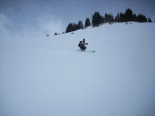
Winter Telemark Skiing Photos: A Few To Keep the Winter Stoke Going

Well, I was really hoping to get another telemark video posted this week, but we decided to give it one more session in the editing room. It should be done and posted in two weeks - we are off to telemark some backcountry spots in the San Juan Mountains of Colorado and do some long trail running and secret bouldering in Northern New Mexico.

However, to keep the stoke of the telemark season going just a little longer, here are a few photos of winter fun.
Winter Telemark Backcountry Skiing in Colorado
Sure wish it would dump like it was this day. This winter has been warm and dry for the most part, although we have had some good telemark powder days.
Backcountry telemark skiing in Colorado
One of my favorite backcountry slopes. Always stable, always deep, always empty....
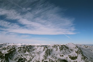
Colorado Backcountry: The Telemark Skiing Opportunities are Endless
The Colorado backcountry skiing possibilities are endless. Just use your imagination....

Friday, March 13, 2009

The Golden Nugget: A Gem On the Front Side of Eldorado Canyon

Earlier this week we went up to the Golden Nugget, one of the best single boulders on the front side of Eldorado Canyon. Sitting at the edge of a beautiful meadow, the Golden Nugget offers around 15+ individual problems - plus many eliminates or link ups. Although most problems go at the softer end of the grade scale, there are two that are incredibly hard.
Tara on the Golden Nugget Boulder
Old school in style, the problems on the Golden Nugget are vertical, crimpy, and 15 high. The top out is flat, the landing is flat, and the stone is solid. On cold winter days, you can usually find a patch of sun on the south side to warm up while resting before trying to send of the impossibly crimpy problems on the west face.
Bouldering on the Golden Nugget Boulder
On the far left are the two prize gems. If you do the low stand start (no sit start here), the far left problem rates up there in the double-digit V range. Grade wise it is hard to say, in the old days it was rated B2/B2+, but now it can be rated whatever the young upstart boulderer wants to rate it (and probably give it a new name... where has our appreciation of history gone?).
Golden Nugget Bouldering Problems
The boulder sits on the edge of Boulder Open Space and Mountain Parks Habitat Conservation Area. That means that you can't access it from the Mickey Mouse Trail. Rather, according to the ranger we talked to, you need to walk the road all the way around to the old Mickey Mouse Trail, and use the shortcut from there to the boulder (about 25 feet). What they don't want people doing is hiking the trail, and then cutting down through the meadow (which often is home to a family of wild turkeys).

Thursday, March 5, 2009

South Boulder Peak: A Spring Trail Run to Test Your Fitness

I've been slowly ramping up my running mileage now that spring is just around the corner (although with the current weather we have been having, someone will have to tell all the plants that it is not here yet). Normally, I tone down my mileage during the winter for a couple reasons:
  • to telemark in the backcountry
  • to give myself some time off from running
  • and give my psyche a break so that come spring I'm ready to go.

As spring begins here along the Colorado Front Range, I'm beginning to add a few more climbs to my trail runs and to see where my body has gotten to over the winter. Backcountry skiing really helps keep me in shape as it is a great cross-training exercise for trail running, gets you up high in the mountains for altitude training (I spend about 10+ hours a week training above 10,000 feet), and allows you to enjoy your normal trails and runs in a different season.

So, to test how I am doing this spring, I ran from my house to the top of South Boulder Peak the other day and back. I thought I would do just fine up to the base of Shadow Canyon, as that is part of my usual winter training run down low, and then have to speed hike the steeps to the top. I was pleasantly surprised when I found myself still going (albeit at a slow pace) up the canyon for most of the way. I had to speed hike a few sections in the heart of the canyon up the steep rock stairs, but I was able to pick up the pace for the last bit to the saddle and then the final climb to the top of the peak. The run back home was long and my feet started to get sore from the rough mileage, but I was really surprised and happy.

Looks like this summer is going to be a good one for running mountains... of course, the next day my quads were really telling how I was doing.


South Boulder Peak from South Boulder Creek Trailhead

  • Start - End Elevation: 5,645'- 8,549' (8,549' max elevation)
  • Round-Trip Length: 12+ miles
  • Skill Level: Strenuous
  • Trailhead: 1401 South Foothills Highway. West of Highway 93 at Thomas Lane, approximately 0.5 miles north of the intersection of Highway 93 and Eldorado Springs Drive.