Ran the loop around the Keyser Creek basin today, with summits of Byers Peak (12,804') and Bills Peak (12,703'). This is another excellent loop run traversing a high alpine basin in the Vasquez Wilderness. I started at the Deadhorse trailhead, running up the secret trail until hitting the road to the Byers Peak trailhead. From there, I ran up the Byers Peak trail to the summit of Byers. From here, you descend off the south side of Byers, following the ridge. There is no trail from Byers to Bills, but it is fairly obvious and the ridge holds a fun section of 2/3 class scrambling. Once you are on Bills, you are at the southern end of the Keyser Creek basin, and can look across towards Bottle and your way back home. From Bills Peak, you run down west and then north along the long Bills Peak ridge mostly off trail, although there are faint markings for the St. Louis trail. Take this all the way back to treeline, and when you can see Lake Evylen on your left (west), go another couple hundred yards on the ridge and then make a sharp turn back east and south and drop into the Keyser basin. There are some cairns here, but the trail pretty much disappears in the basin, as you descend and then follow along Keyser Creek. Every once and awhile you will see a cairn, but I spent some time trying to figure out just which way to go. Eventually the trail re-appears and you can follow it to the junction for Bottle Pass. Run back up and over Bottle Pass and then back down the other side to the regular Byers Peak trail. From here, just head on back down and retrace your steps.
Byers Peak sees some traffic (I ran into one party on it today, Sunday), but Bills rarely sees anyone on the summit, and from Byers to Bills and into the basin and then back to Bottle Pass you will not see anyone. It is evident just how empty this area is (it is an official wilderness area) by the fact that the trail really does not exist along this entire way - you are mostly running on alpine tundra and then scree and mossy grass down in the basin (so it can be slow going at times). The full loop is 19.1 miles with ~6,100' of gain and ~6,100' of loss. Today I ran the loop in 4:44 with time for pictures and food on the summits. The loop can be done faster, but since this was my first time, I spent a little time trying to find my way in the Keyser basin and enjoying the views.


Looking at Bills from Byers summit

South off of Byers summit

Looking back at Byers from Bills summit

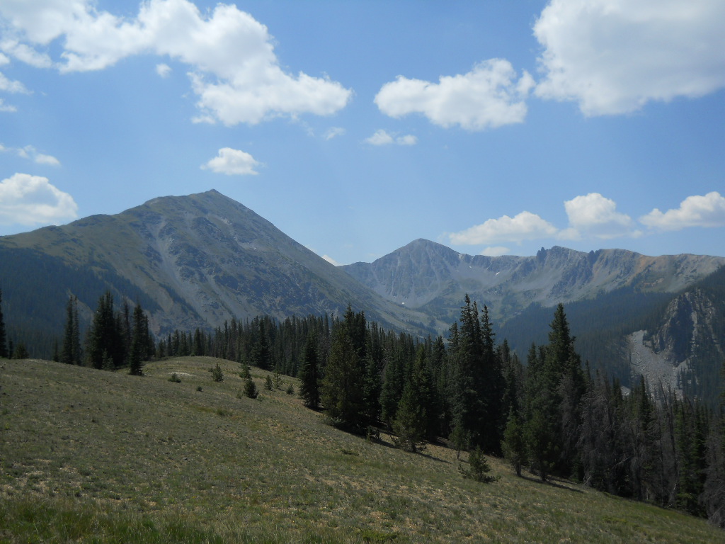
Looking back at Bills after the long ridge around the basin

The sign in the bottom of the basin showing you are on the right path
From the fake Bottle Pass looking at the Keyser Creek basin. The run follows the skyline from left to right and beyond
No comments:
Post a Comment