Here is another post from a couple weeks ago...
One of the better mellow runs along the Frontrange is the Peaceful Valley/Camp Dick run. The trail winds its way along the north side of the South St. Vrain River for 4 miles, climbing gently from ~8,500 feet to ~9,200 feet. At this point, the trail comes out of the trees and joins up with the old mining road that used to go up towards Oglalla Peak and the Middle Saint Vrain River. The road is closed, as it is part of the Indian Peaks Wilderness area, but there is still some mining evidence at around treeline.
You can either turn around here for an easy 8 mile run, or you can continue up for several more miles to the Saint Vrain Glacier (really just a permanent snowfield) or to Buchannan Pass (a great run, but one I prefer to do from Beaver Reservoir via Coney Flats).
When I ran this with my camera, the snow was still melting at a fairly good rate, and several miles above the split to Buchannan Pass or Saint Vrain Glacier the trail disappeared and turned into a swampy mess. I kept going all the way to the Glacier, but before I could tag the summit of Ogalalla Peak the storm clouds were really rolling in.
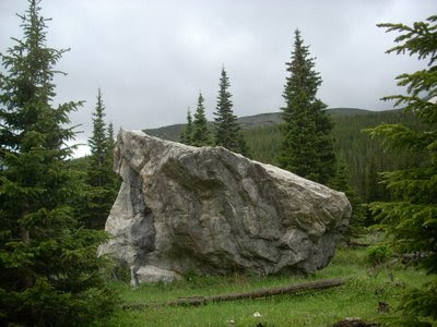
No worries though, the flowers were blooming, the trail was empty (except for the lower section around Camp Dick), and a number of boulders revealed themselves to me. Plenty of undone boulder problems are waiting for anyone who wants to haul in a pad (7 miles one way).
The numbers for those who need them:
Elevation: Starts around ~8,500; ends around ~11,600 (unless you do the last 500 feet to the Divide).
Miles: ~7.5 miles one way.
Time: ~3 hours depending on how often you stop to take in the views and snap photos of flowers


No comments:
Post a Comment