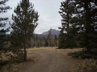
Running single-track is always such a pleasure, but running single-track trails well after the season normally closes is a treat - there is no one out, the temps are always nice, and the forest and wildlife have settled into their more somber and quiet winter state. Taking advantage of this, Tara and I decided to run the Salt Creek Trail (#618) and its various off-shoots.

There are several access points onto this trail.
- FDR 435 Brush Park. You can reach this road from US Highway 285. The trailhead is at the end of FDR 435. You can hike either direction on the trail from this location.
- FDR 436 Middle Fork of Salt Creek. You can reach this road from US Highway 285 at the same location. Follow FDR 435 to FDR 436. The trailhead is not as well marked at this location.
- FDR 431 Turn off of US Highway 285 onto the Buffalo Springs Road. The Lynch Creek Trailhead is located at the end of FDR 431. The Salt Creek Trail crosses FDR 431 at several points. Salt Creek Trail can also be accessed from FDR 433, which connects FDR 431 to US Highway 285 via Pony Park. It can also be accessed from Tumbling CreeK trail in the Fourmile Drainage on the Salida Ranger District. Follow County and Forest Service Road 377 from Buena Vista to FDR 375 to its end at the Fourmile Trailhead. This section is not open to mountain biking since it is in the Wilderness Area.
We came in from the last of these options, taking the Fourmile Drainage from Trout Creek Pass and ran north.
View Larger Map
As you can see from the map, the terrain is quite nice. Rolling hills in a quiet forest setting for about 15 miles one way. You can eventually take trail #618 all the way to the northern terminus (Lynch Creek Trailhead on Forest Road 431), at which point you are able to connect to the Rough and Tumbling Trail (#617). It is possible to take #617 around to the north and west of West Buffalo Peak and down towards Forest Road 375 (Fourmile Road) and then back to your starting point for a grand circumnavigation trail run of East and West Buffalo Peaks.

Total distance is 35+ miles all on single-track or closed Forest Service roads. This is one of the better, longer single-track trail runs found in the Colorado Rocky Mountains. Perfect for fall or even summer, as much of the run is above 10,000 feet and in the trees.
If you don't want to do the entire 35+ mile loop, as it requires some planning, the Salt Creek Trail (618) is a worthy trail run on its own.
Difficulty: Easy to Moderate
Elevation Gain: 2,250 Feet (701.4 Meters)
High Point: 11,100 Feet (3460.1 Meters)
Length, One-way: 15.5 Miles (25.83 Kilometers)
Usage: Moderate
USGS Maps: Marmot Peak and Jones Hill
Hey Peter,
ReplyDeleteThanks for the comment on trailrunner.ca. Ya, conditions here got nasty with a cold snap. Oh - miss Colorado. The TransRockies 07 was my first real bout with its beauty and it's stunning. A stupid injury kept me from doing much this past summer, but maybe I'll get back there. Enjoy the scenery!
Sounds like the entire Rockies got shut down this past week. If you do ever come back down to Colorado, shoot me a line. I'd be happy to show you some amazing trail runs that go for miles and miles.
ReplyDelete